


2024’s Top 9 LiDAR SLAM Alternatives
LiDAR SLAM pioneered by Australia’s national science agency, CSIRO in 2008, is a groundbreaking technology central to GeoSLAM’s innovative products. GeoSLAM Beam and Connect enable precise data georeferencing in diverse environments, outperforming competitors with the Velodyne VLP-16 sensor. Widely used in autonomous vehicles, LiDAR SLAM is crucial for mapping and localization, offering unparalleled efficiency in challenging settings like indoor spaces and forests.

Looking for alternatives to LiDAR SLAM? Explore SLAM, Visual SLAM, VSLAM, Visual Odometry, LDS, Laser, SFM, Gyroscope, and more for diverse applications in robotics and autonomous tasks.
SLAM
A rapid evolution in digital technology has given birth to SLAM, otherwise known as Simultaneous Localization and Mapping. Predominantly used in autonomous vehicles, this high-tech method aids in real-time map building and vehicle localization by processing vast sensor data.
SLAM Top Features
- Versatility: Beyond autonomous vehicles, SLAM also finds applications in home robot vacuums, warehouse mobile robots, and drones in unknown environments.
- Visual SLAM: Leverages a mix of lens cameras, stereo cameras and depth cameras with graph-based optimization to enhance real-time data processing.
- Lidar SLAM: Employs laser sensors, suitable for high-speed vehicles, for precise measurements and depth metrics which are highly effective in map building.
| SLAM Technology Components | Application |
|---|---|
| Sensor signal processing (front-end) | Facilitates obstacles mapping by processing sensor data. |
| Pose-graph optimization (back-end) | Assists in accurate vehicle localization. |
SLAM Limitations
- Localization Errors: Deviations may accumulate over time, leading to significant difference from actual values, a dilemma known as the loop closure problem.
- Computational Cost: Image processing imposes a high computational cost.
SLAM Pricing
As SLAM is a method or algorithm, its pricing largely depends on the particular application in which it is embedded, the sensors used, and the software with which it interfaces. However, various open-source SLAM implementations are also available.
SLAM Use Cases
Use Case 1: Home Robot Vacuums
SLAM empowers robot vacuums to efficiently navigate around obstacles while cleaning your home – building real-time maps to guide their cleaning paths.
Use Case 2: Autonomous Vehicles
In autonomous vehicles, SLAM plays a pivotal role in real-time localization and mapping to ensure safe navigation.
Use Case 3: Drones
For drones operating in unknown environments, SLAM aids in the detection and navigation around obstacles by building real-time maps.
LiDAR
LiDAR, short for Light Detection and Ranging, is an established technology that has been around for over 50 years. Despite its early inception, the cost initially prohibited its mass-market application. However, the technology has fundamentally transformed over the years and has found greater accuracy in mapping positions, distances, object detection, and 3D imaging, compared to its counterparts.
LiDAR Top Features
- Accuracy: LiDAR provides high-precision data, being able to map positions and distances with a remarkable level of detail. This precision results from its use of time of flight sensing to measure distances.
- Extensive Application: The technology is extensively used in automation applications, mapping and related applications. Its widespread adoption is evident with its use in powerline corridor surveying, mapping landforms, and coastal areas.
- Powerful Use in Vehicles: LiDAR has been a most preferred sensor in driver assisted and autonomous vehicles. Since the 1990s, it has been used in semi-autonomous vehicles for adaptive cruise control.
- Consumer Electronics: Major consumer electronic devices such as the iPad Pro and iPhone 12 Pro use LiDAR for imaging and Augmented Reality applications.
- Ground Mapping: LiDAR excels in mapping surfaces and it’s used for highly accurate ground topping through the use of a technique called bare-earth filtering.
| Manufacturers | Offerings |
|---|---|
| Hokuyo | Scanning LiDAR sensors for precision mapping and traffic monitoring. |
| LightWare | Compact, lightweight 1D, 2D rangefinder sensors, favoured by drone manufacturers. |
LiDAR Limitations
- Cost: LiDAR technology is expensive, curtailing its widespread adoption.
- Item Dependency: Performance depends heavily on laser power and wavelength.
- Mini-Restrictions: LiDAR faces challenges in steep, forested areas, where it might achieve accuracy levels of only within 1 to 2 feet.
LiDAR Use Cases
Use Case 1: Autonomous Vehicles
LiDAR has been instrumental in the rise of autonomous vehicles. Its ability to generate precise 3D maps and lambently identify objects enables self-navigation of these cars, contributing to an emerging revolution in transportation.
Use Case 2: Geology and Oceanography
The detailed mapping capability and extreme precision of LiDAR makes it a valuable resource for geologists and oceanographers to gain insights from the Earth’s surface and undersea terrains.
Use Case 3: Architecture
LiDAR is used in rendering detailed 3D images of buildings, helpful in architectural planning and construction. The precision it provides aids in ensuring accuracy throughout the design and construction phases.
Visual SLAM
Emerging from the confluence of Computer Vision, AI, and Robotics, Visual SLAM (Simultaneous Localization and Mapping) crafts a cutting-edge technology portfolio optimized for autonomous systems. It enables exquisite navigation without relying on pre-existing maps or external positioning, giving it a unique edge in this tech era.
Visual SLAM Top Features
- Integration of Computer Vision, Artificial Intelligence, and Robotics
- Enables autonomous navigation without pre-existing maps
- Uses visual features from images for mapping and estimating movement
| Origin | 1980s research with range sensorsnLate 1990s breakthroughs in mobile robotics |
| Key Algorithms | Feature-based PTAM, ORB-SLAM, LSD-SLAM, and DSO |
| Cameras used | Camera(s) that include global shutter and grayscale sensor (typically VGA resolution) |
Visual SLAM Limitations
- Localization errors can accumulate over time, causing deviation from actual values
- Specific visual SLAM camera specifications are required
Visual SLAM Use Cases
Use case 1: Robotics
Visual SLAM is instrumental in robotics, particularly in R&D, where the complexity of autonomous navigation requires robust solutions.
Use case 2: Autonomous Vehicles
With the autonomous vehicles market substantially driving the growth of the global SLAM market, Visual SLAM’s features to estimate movement and map environments make it a desirable technology.
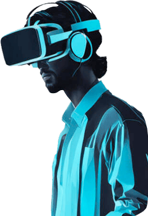
Use case 3: AR/VR Startups
As AR/VR startups innovate, the use of Visual SLAM for accurate localization and mapping offers a significant edge in the creation of immersive experiences.
VSLAM
If there’s something that turns vision into intelligence, it’s VSLAM – a powerful simultaneous localization and mapping (SLAM) method. A cherished tool of autonomous vehicles and home robots, this technology brings mapping and localization together in sync, optimizing the tracking of spacial environments.
VSLAM Top Features
- Ability for simultaneous mapping and localizing.
- Applicable to practical solutions, from home robot vacuums to self-driving cars.
- Employs differing algorithms to enhance tracking clarity.
- Offers variations like monocular SLAM that utilizes a single camera.
- Supported by both sparse (PTAM, ORB-SLAM) and dense (DTAM, LSD-SLAM, DSO, SVO) methods.
| Benefits | Details |
|---|---|
| Pose-Graph Optimization | An advanced back-end component of SLAM technology for accurate mapping. |
| Landmark Identification | Vital for mapping processes, offering precise environmental markers. |
| Sector Adaptability | With global shipments of AGVs/AMRs exceeding 100,000, VSLAM is widely adopted. |
VSLAM Downsides
- Accumulation of error in localization.
- Potential for localization failure, hindering accurate mapping.
- High computational costs associated with image and point cloud processing.
VSLAM Use Cases
Use case 1: Robotic Applications
Autonomous cleaning robots are becoming increasingly popular. With VSLAM, these robots can efficiently trace their path in dynamic household environments without any localization errors.
Use case 2: Medical Field
VSLAM leaves a notable impact in medical explorations and surgeries where precise measurements and landmarks are of paramount importance.
Use Case 3: Entertainment
The Walt Disney Company, for instance, uses SLAM technology for its Virtual World Simulator, creating immersive and comprehensive virtual realities.
Visual Odometry
Immersing ourselves in the dynamic realm of spatial imaging, we find a fascinating solution, Visual Odometry (VO). This process, pivotal in determining the position and orientation of a robot, relies heavily on the rich depth within camera images. Notably employed by Mars Exploration Rovers, VO is akin to traditional odometry, where distances are principally estimated via camera images.
Visual Odometry’s Superior Features
- Adaptable Vo Types: Ranging from Monocular (single camera) to Stereo (two camera) VO, and even Visual Inertial Odometry that incorporates an Inertial Measurement Unit.
- Methodical Process: VO follows a systematized structure, undertaking stages such as image acquisition, correction, feature detection and extraction, correlation and camera motion estimation.
- Unique method alternatives: Feature-based and direct method that leverages pixel intensity as visual input.
| Advancements | Application |
|---|---|
| Computer Vision | Improves precise landing capabilities of UAVs and obstacle avoidance |
| Sensor Technologies | Facilitates autonomous navigation in GPS-denied or indoor environments |
| Machine Learning Integration | Enhances the performance of visual SLAM, allowing robots to build maps in unknown environments |
Visual Odometry’s Probable Drawbacks
- Drift: Errors tend to accumulate over time, impacting precision.
- Occlusions, Motion Blur, Rapid Camera Movements: These could hinder the functionality of VO.
- Quality of Features and Lighting Conditions: They largely affect VO’s effectiveness and depend heavily on environmental factors.
Visual Odometry Use Cases
Use case 1: UAV Navigation
VO proves indispensable in environments with limited GNSS signal or datalink to the Ground Control Station, promoting heightening accuracy of UAV missions.
Use case 2: Robot Navigation
Especially on Mars Exploration Rovers, VO aids in determining rover location and direction using rich camera images.
Use case 3: Autonomous Navigation
In GPS-limited or indoor environments, VO’s integration of advancing sensor technologies augments autonomous navigation capabilities.
LDS

The Church of Jesus Christ of Latter-day Saints, or simply the LDS, boasts a rich history of technological adoption and innovation, intertwining their mission with the pulse of modern communication trends.
LDS Top Features
- Early Tech Adoption: LDS has been embracing innovative communications technology since the inception of the 1867 telegraph line and subsequently, the telephone.
- Broadcasting Milestones: The church established radio station KZN, aired regular series by the Mormon Tabernacle Choir and initiated closed circuit television broadcasts, all impressive feats in the broadcasting landscape.
- Diverse Digital Capabilities: Leveraging satellite networks, general-purpose computers and the internet, LDS has efficiently utilized digital tech to distribute content in 27 languages.
- Interactive Online Presence: With a robust blend of interactive websites, LDS.org, FamilySearch.org, ProvidentLiving.org, and Mormon.org contribute invaluable conversations to the cyber landscape.
| Communications Advancements | Year Implemented |
|---|---|
| Telephone | Shortly after 1876 |
| Computers | 1954 |
| Internet Presence | 1996 |
LDS Limitations
- Internet Dangers: LDS leaders acknowledge the adverse effects of technology, such as risks of cyberbullying, web predators, malicious software, and an estimated 25{66f7997927a862c9f57ec7dffc6a2fe6d405caee7001dff533b976d48fe118b1} of daily internet searches being porn-related.
- Dependency Issues: The increased demand as technology has evolved may lead to higher dependency on it, impacting both individuals and organizations.
LDS Use Cases
Use case 1: Family Safety with Tech
LDS provides families with guidelines for safe use of technology, ensuring a balanced digital life.
Use case 2: Youth Outreach & Missionary Applications
Through modern applications, lesson-centered and video content, LDS serves as a digital missionary, empowering its youth with knowledge.
Use case 3: Global Communication & Training
Leveraging satellite networks and a host of digital technologies, LDS has broadened its communicative scope for global training purposes.
Laser
The laser, an innovation tracing back to the early 1900s with Albert Einstein’s prediction of stimulated emission, is transformative across industries such as medicine, retail, and industry.
Top Laser Features
- Variety of applications: From diamond drilling to supermarket scanners and surgical procedures, lasers are incredibly versatile.
- Efficiency and cost-effectiveness, particularly with CO2 lasers.
- Major input in the billion-dollar laser industry, hence contributing to economic growth.
| Feature | Details |
|---|---|
| Ongoing Evolution | Continuous advancement over the decades has led to developments such as the quantum theory of stimulated emission. |
| Radiation Amplification | Lasers can amplify radiation, a theory presented by Valentin Fabrikant in 1939. |
| Use in Research | Lasers support vital research, such as atmospheric analysis and energy generation through nuclear fusion. |
Laser Limitations
- Despite significant progress, the technology still requires refinement and optimization.
- Laser applications can be expensive and capital-intensive, particularly for small businesses and startups.
Laser Use Cases
Use Case 1: Medicine
lasers play a crucial role in many medical procedures, including surgeries and therapeutic application.
Use Case 2: Retail
From barcode scanning to security systems, the retail industry depends heavily on laser technology.
Use Case 3: Industrial Processes
Lasers facilitate a variety of industrial processes such as cutting, welding, and drilling metals. This ability makes them a cornerstone of modern manufacturing.
SFM
Dive into the world of SFM (Structure from Motion), a robust photogrammetric range imaging technique. Used widely for estimating 3D structures from 2D images and augmenting reality, SFM proves instrumental in fields like computer vision and visual perception.
SFM Top Features
- 3D Structure Estimation: Converts 2D image sequences into detailed 3D structures
- Versatility: Finds usage in diverse applications like 3D scanning, AR, and vSLAM
- Scalable Algorithms: Adapts to varying numbers and types of cameras used
- Flexible Computation: Permits extension to more than two views, often employed in robotics and autonomous driving
| Feature | Description |
|---|---|
| Algorithm Structure | Assumes a single camera at the origin with an optical axis aligned along the z-axis |
| Feature Matching | Deploys Kanade-Lucas-Tomasi (KLT) algorithm for inter-camera feature matching or tracking |
| 3D Points Computation | Calculates 3D points from tracks through triangulateMultiview |
SFM Limitations
- Accuracy of scale computation of structure and motion relies on additional datasets
- Relies heavily on the assumption of single camera at the origin
- Requires the use of RANSAC algorithm to eliminate outlier correspondences
SFM Pricing
The intricacies of the price structure are not specifically defined in the summary provided. Please refer to the official resources for accurate details.
SFM Use Cases
Use Case 1: Geosciences
SFM demonstrates significant utility in geosciences. Through non-invasive and low-cost method, it aids in creating models of hyperscale landforms.
Use Case 2: Autonomous Driving
Within autonomous driving, SFM is instrumental in 3D structure recovery and mapping through its ability to process more than two views.
Use Case 3: Cultural Heritage Management
SFM is commonly adopted in cultural heritage management for structure control, documentation, and conservation planning thanks to its precision and scalability.
Gyroscope

The Gyroscope, also known as an angular velocity sensor, is a precision instrument that tracks changes in rotational angle over time. Renowned for usage in a wide range of devices, from smartphones to industrial equipment, the Gyroscope is an essential, highly accurate and versatile component in modern technology.
Gyroscope Top Features
- High-Quality: Epson’s gyro sensors use a proprietary high-quality quartz crystal with a robust double-T structure.
- Variety: Epson offers a range of gyro sensor variations including vibration, mechanical, and optical.
- Efficient: Gyroscopes are energy efficient, improving user experience with minimal battery drain.
- Precision: Utilizing Coriolis force, Epson gyro sensors deliver incredibly precise angular velocity readings.
- Resistance: The symmetrical arms, supported at the center, offer substantial resistance to impact.
| Feature | Benefit |
|---|---|
| Low Noise Characteristics | Improves sensor accuracy and reliability, especially in noise-sensitive applications. |
| Good Temperature Characteristics | Ensure consistent performance across a wide range of ambient temperatures. |
| 3-axis Acceleration Sensing Capability (MEMS gyroscope) | Makes them perfect for precise motion sensing in electronic devices. |
Gyroscope Limitations
- Dependent on material and structural differences, accuracy in measuring angular velocity may vary.
- Despite impact resistance, extreme conditions could potentially disrupt functionality.
Gyroscope Use Cases
Use case 1: Smartphones
Gyroscopes significantly enhance user experience in smartphones by aiding in navigation, gaming, and photo stabilization. Their energy efficiency means improved performance for longer periods.
Use case 2: Gaming Consoles
In gaming consoles, gyroscopes facilitate immersive experiences by enabling highly accurate motion sensing, contributing to responsive and realistic gameplay.
Use case 3: Industrial Equipment
Robust and reliable, gyroscopes in industrial equipment provide precise measurements, leading to improved operational efficiency and safety.