Augmented Reality Utility Industry – Top Use Cases
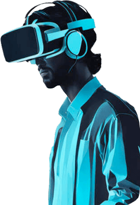
You’re probably familiar with Google Glass — that futuristic pair of glasses that lets wearers access their smartphones through a pair of “smart glasses”. And what a dud that was. You’ve also likely heard about Microsoft’s HoloLens, which allows users to interact with holographic objects floating in midair; a partial dud but nonetheless a huge step in the right direction. And then, of course, the tool that is sitting in everyone’s pocket or being used to read this article.
While headsets still have a ways to go before any sort of mass adoption in the Utility Industry, the smartphone, with its ever-improving lidar technology and processors, is finally to a point where it can start to offer serious business value.

Augmented Reality in the Utility Industry offers several use cases that can no longer be ignored. We’ve done our best to include those which are less talked about, the niche use cases that the Utility Industry is starting to take advantage of.
Documenting and Identifying Vegetation
Electrical Utilities need to clear vegetation from their lines to avoid any interference with their service. This can include anything from downed power lines to blocked sewers. Vegetation control and removal methods are used to prevent service disruptions by keeping vegetation away from utility equipment.
Using augmented reality the field technician can scan an environment, have image recognition recognize vegetation, and then start to create both a 2d and 3d map of the vegetation data. And this could all be done in the background, while the technician is performing non-related duties. Just think how fast an area of vegetation could be mapped out with a fleet of technicians wearing headsets.
Mapping Underground Utility Lines
A recent study published in 2019 by Arizona State University demonstrated the value that augmented reality had in mapping out underground utility lines.
The paper aimed to improve access to and utilization of available GIS data. The researchers designed a system to overlay 3d utility lines to be visible through augmented reality for on-site workers as well as available to off-site workers on google maps.
By continually collecting and communicating data captured by onsite workers, a remote server could parse the captured data and visualize it on a map to help the workers make decisions in near-real-time.
The results revealed that 86{66f7997927a862c9f57ec7dffc6a2fe6d405caee7001dff533b976d48fe118b1} of the participants validated the system’s adaptivity to the underground construction. We can conclusively say that this research has produced an efficient solution for data collection and sharing among stakeholders in the underground construction industry
Remote Expert Assistance
This is a more general use-case that you’ve probably heard before but nonetheless an important one worth mentioning. Field technicians often need the help of experts to understand the equipment they are working with. With augmented reality, the technician can simply look at a piece of equipment while an off-site operator can see through the eyes of the technician. The remote expert can then draw arrows onto their 2d screen which show up in 3d for the technician. This certainly takes video chatting to an entirely new level of usefulness.
Data Collection
Utility providers are having to deal with more and more big data. How they collect this data is in most cases quite archaic and not up to date with what’s now possible. We’ve seen operators and maintenance personnel put their bodies in unwarranted places just to be able to read the temperature on a boiler for example. Then they’ll write down the value, head back to the office, and record it into a spreadsheet. It really doesn’t have to be this way anymore.
Instead, they could look through their phone camera and see a large meter floating above the machine, tap on it, and hit record value which automatically records the value into a spreadsheet. In fact, this is one of the main features of Aircada Pro.
On the consumer side, when a customer spots a problem in a particular utility, maybe an electric line that looks like it is about to fall over, they could place a 3d tag over the line and report it. This information could alert the utility company to have them better understand the severity of a disaster at a given location so that you can respond more quickly, plan downtime more efficiently, and provide a better customer experience.
Trench Inspection
Another study published all the way back in 2012 by the Graz University of Technology showed that by being able to visualize trenches in a 3d space (compared to 2d), the risk of accidentally damaging underground infrastructure was reduced by using a view that shows the infrastructure overlaid on the real world. For example, an augmented reality device can be used by a shovel excavator operator to help them determine where to dig.
The simplicity of surveying new objects was rated higher than with conventional surveying techniques (avg. 5.44, stdev 0.96). AR can support the users with more easy and intuitive handling of the task.
Increased Safety Through Visual Geofencing
Field workers have sensors that track their location and health. Wearable technology can be used by employers to monitor an employee’s health and location in real-time, which can help to keep them safe. This technology can track things like heart rate, respiration, and location, allowing for a more accurate view of an employee’s wellbeing.
Additionally, employers can use wearables to monitor employee movements and ensure that they are adhering to safety protocols. Wearable technology can improve safety by providing workers with information on their surroundings and any potential dangers they may face. This can help to keep them safe while on the job.
To make informed decisions, it is important to be aware of where danger zones are. Whenever the devices detect danger, it is possible to set up zones that will be automatically highlighted. Knowing where danger zones are in the field is helpful, but it’s more important to be able to see them first hand. If a danger zone is identified, a giant warning symbol can be placed in front of the location which can easily be recognized and avoided through augmented reality.
Reducing Energy Costs for Consumers
As electric bills continue to rise across America, many consumers are looking for ways to cut down on their power bill. One simple thing they can do is increase their energy efficiency. However, simply knowing how much electricity you use isn’t enough. You need to know where those kilowatts go so you can take actionable steps to save money.
This is where augmented reality comes in. Electric companies already use mobile apps to give customers feedback and insight on electrical usage. But by combining this data with geospatial mapping software, utilities can provide an accurate picture of how much electricity individual appliances consume.
For example, imagine you’ve got a dishwasher running 24 hours a day. Your electric company knows it uses 40 kWh per month. But you can tell by looking at the numbers that it consumes twice as much energy as it should. Through augmented reality smart meters, you can check the actual wattage of your dishwasher and adjust settings accordingly. Now your dishwasher won’t run up your next month’s bill.
Challenges With Augmented Reality in the Utility Industry
While the hopeful optimist might disagree, several challenges still need to be overcome in order for augmented reality to truly be adopted by the utility industry at scale.
Industry is Slow to Adopt New Technology
One of the biggest challenges in implementing virtual and augmented reality is that the utility industry as a whole is slow to adopt new technologies. With so much at stake if something goes wrong (which certainly happens with emerging technology), the potential cons often outweigh the pros. We’ve personally seen many organizations still using pen and paper to store data, document issues, and so on, which suggests augmented reality is probably far off their radar for the near future.
The Infrastructure Isn’t Fully in Place
How will augmented reality perform when there is no access to wi-fi? What if a headset runs out of battery deep within an underground construction site that has limited power sources?
Headsets Just Aren’t Quite “There” Yet
Let’s be honest here. The available headsets on the market still have a ways to go before it makes sense to use one. If hands-free is an option, excellent, most mobile phones can now do the job. But when hands are needed to get a job done, a headset may be the only option. And so far, what is available just isn’t ergonomic, comfortable to use for many hours, and lack a proper field of view. The HoloLens2 costs around $3500 and only gives the user around a 45-degree field of view.
Lack of User-Friendly Apps
Technicians need to be able to easily and quickly understand how to use an augmented reality app to continue using it after a single-use. As of now, most apps that use augmented reality have a large learning curve that takes a lot of getting used to. Developers need to bridge the usability gap between 2d and 3d interfaces before any serious adoption occurs.
Despite the challenges, augmented reality is here to stay and the utility industry certainly has a lot to gain by adopting it. We look forward to a time when it’s hard to imagine getting through our day-to-day without ever touching this technology. How many years away is that? Our best guess is at least 5-10. And that’s why we’re doing everything we can to help speed up this adoption.