Reality Capture by Capturing Reality, a Slovak company founded in 2013, offers groundbreaking 3D modeling software used across various industries like cultural heritage, gaming, and VFX. It generates textured 3D meshes and orthographic projections efficiently, appealing to professionals due to seamless integration into workflows.
For those exploring options beyond Reality Capture, alternatives include Pix4D, ReCap Pro, Agisoft, Metashape, 3DF Zephyr, Meshroom, ContextCapture, Canvas, PolyCam, SiteScape, Scandy Pro, Kiri, WiDAR, Scaniverse, and PolyCam Pro.
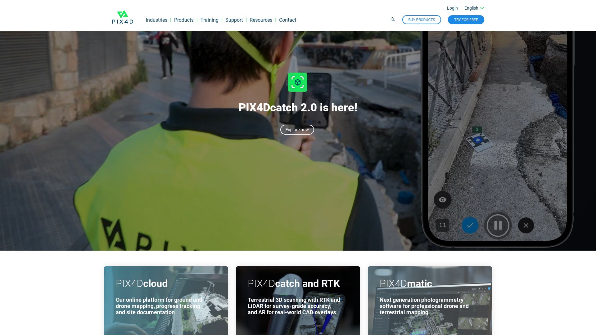
Pix4D
Considered a trailblazer in the domain of drone mapping and photogrammetry software, Pix4D reigns supreme in its worldwide offices. Its essence lies in empowering individuals to create professional 3D maps, with a broad-ranging image source compatibility that includes hand-captured, drone-taken, and plane images.
Top Features of Pix4D
Pix4Dmapper: A potent photogrammetry software offering the transformation of images into precise 2D maps and 3D models.
Includes personal customer support, and access to abundant learning resources.
Pix4Dreact: A cutting-edge solution catering to public safety and emergency response sectors by creating 2D maps from drone images.
Pix4Dcapture: A comprehensive flight planning mobile app designed for seamless mapping and 3D modeling.
Feature
Description
Subscription Benefits
Subscription includes Software upgrades, learning paths for training, and optional Cloud processing with a Pix4Dmapper license.
Pix4Dcapture
Users get flexible control over flight plan and parameters. Available for both Android and iOS.
Payment Options
Supports various payment methods such as credit card, PayPal, and wire transfers for certain amounts.
Pix4D Limitations
Despite its many strengths, Pix4D does not seem to offer refunds for cancellations, and changes to subscriptions are only reflected at the end of the billing cycle.
Pix4D Pricing
The exact pricing isn’t specified, but Pix4D offers flexible subscription models that can be modified or cancelled at any time. Payments are accepted through credit cards, PayPal, and wire transfers for amounts above 1500 USD, EUR, CHF.
Pix4D Use Cases
Public Safety and Emergency Response
Pix4Dreact is a lifesaver in times of crisis. It creates 2D maps from drone images, which can provide essential insights for emergency response teams.
Professional Map Creation
With its potent Pix4Dmapper software, Pix4D makes the creation of professional 3D maps and models from varied image sources an effortless task.
Aerial Imaging
Pix4D allows for wide-ranging aerial image mapping applications, broadening the possibilities in sectors that heavily rely on aerial imagery.
ReCap Pro
A product of Autodesk, ReCap Pro connects the physical world to the digital realm using 3D scanning technology, creating intricate 3D models from photographs and laser scans.
ReCap Pro Top Features
Facilitates collaboration through reality-based design.
Incorporates ReCap Photo service, an innovative technology processing drone imagery to create 3D representations of site conditions and objects.
Offers ReCap Pro SDK for the seamless integration of reality data into Autodesk design and construction tools.
Utilizes high-precision GPS technology for high accuracy photo reconstruction, without the need for ground control points preparation.
Unique feature
Benefits
Side-side comparison in RealView and Overhead Map View
Allows for easy comparison and precise modeling.
XY axis setting for user coordinate system in Overhead View using compass widget
Improves navigation and orientation within the model.
GoPro image importing and GPS tag support
Enables geolocation, scaling and compatibility with widely used media formats.
ReCap Pro Limitations
For optimal use, ReCap Pro requires high specification hardware and may not run well on standard computers.
There might be potential limitations in terms of software integrations, like Bentley’s reality modeling software and Pix4D’s drone mapping software.
ReCap Pro Pricing
ReCap Pro is a premium software offering extensive features with pricing starting at $26 per month. It also offers a free trial, and licenses are sold on monthly, yearly, or 3-yearly plans for all-feature access.
ReCap Pro Use Cases
Use Case 1: Construction and Engineering Projects
ReCap Pro translates real-world conditions into complex, accurate 3D models, making it highly beneficial for construction and engineering projects.
Use Case 2: Surveying and Measurement
This software simplifies the time-consuming survey process and is compatible with numerous mobile devices, including iPad Pro, for on-site data measurement, viewing, and marking up.
Use Case 3: Academia and Research
With its accurate 3D modeling and reality capture capabilities, ReCap Pro serves as a powerful tool for academic researchers in the areas of architecture, archaeology, and environmental sciences.
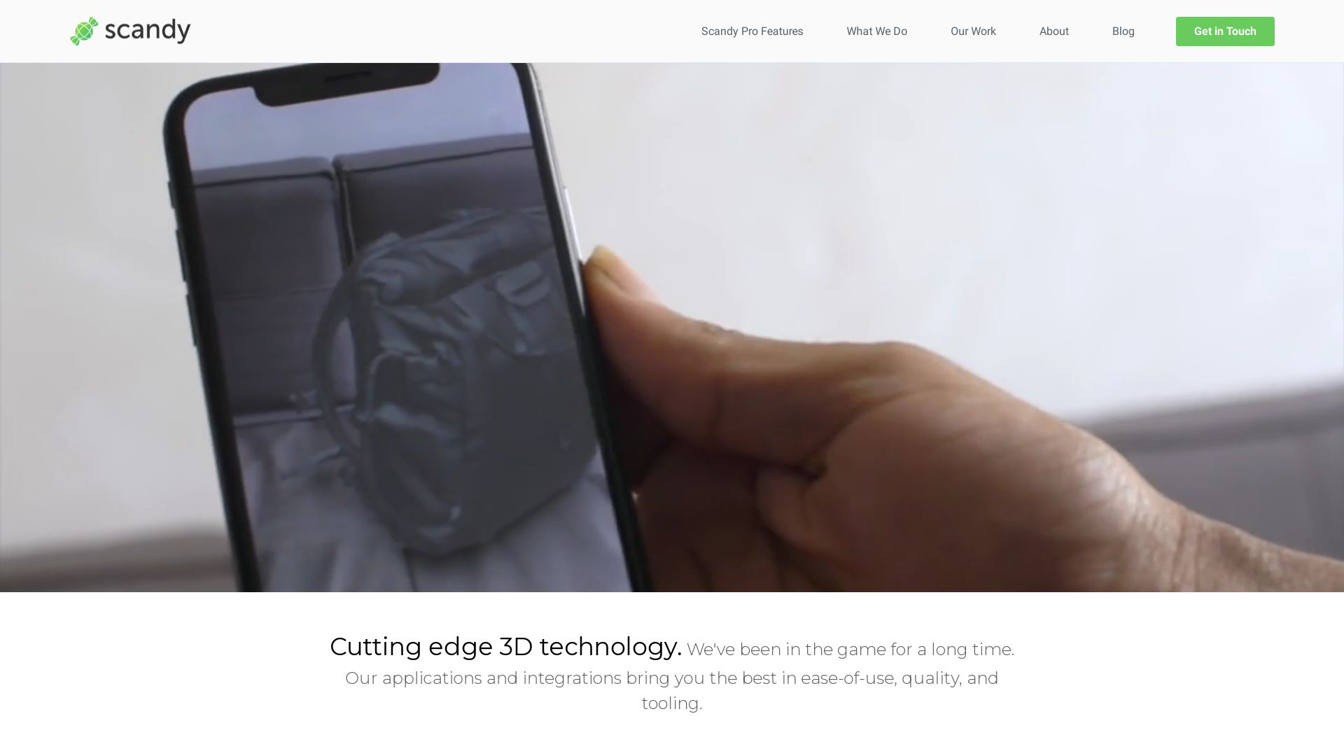
Scandy Pro
Serving as a pioneer in the 3D scanning territory since 2014, Scandy Pro is an ingenious application developed by Scandy Inc. Designed to induce compatibility with a range of Apple devices, this app is a dynamic option for 3D modeling and graphics enthusiasts, prioritizing meticulously detailed scanning and on-device privacy.
Scandy Pro Top Features
Compatibility with multiple iPhone and iPad Pro models.
Allows saving and exportation of scans in numerous file formats and scales.
All rendering occurs on-device, eliminating the requirement for cloud registration or storage.
Single-scan exports available separately.
Available on Android.
Operates through photogrammetry, leveraging 2D photos to generate 3D models.
Feature
Description
Processing and Storage
All scan data, processing, and storage occurs only within the device to ensure utmost privacy.
Scan Resolution
Ability to capture detail as minuscule as 0.3mm within a 0.25m bounding box.
Scan Sharing
Enables users to share scan results on social media, and other platforms.
Scandy Pro Limitations
GPU intensive thereby leading to potential slowdown after numerous consecutive scans.
No cloud storage or backup facilities, eliminating data retrieval possibilities after deletion.
Scandy Pro Pricing
Scandy Pro operates on a subscription model with options at $1.99/week, $5.99/month, and $49.99/year for unlimited scans. Additionally, per scan exports can be acquired separately, offering flexibility to casual users. However, it’s noteworthy to mention that Scandy Pro also presents one free scan export per week, echoing its commitment to user-friendly policies.
Scandy Pro Use Cases
Use case 1: 3D Model Creation
Photogrammetry artists, 3D model creators and designers can leverage Scandy Pro’s high-resolution scans and diverse export formats to create detailed 3D models from real-world objects or environments.
Use case 2: Social Media Sharing
Social media enthusiasts will find Scandy Pro particularly appealing with its provisions to share results directly on Facebook, Twitter, Instagram, Whatsapp, Line, Email, iCloud, and iMessage, thereby enhancing their social presence.
Use case 3: Academic Research
Researchers in fields like Archaeology or Architecture can use Scandy Pro to capture intricate details of artifacts or buildings and later use these scans in their studies or 3D visualizations.
Kiri
Meet Kiri, a cutting-edge player in the realm of 3D scanning, modeling, and processing. Specializing in photogrammetry technology, Kiri embodies innovation via its application of artificial intelligence and is slated for a major upgrade with the integration of Neural Radiance Fields technology.
Kiri Top Features
AI-powered 3D Scanning: Clean, precise 3D models are achieved through the intelligent estimation of featureless parts.
Neural Radiance Fields Technology: On the horizon for June 2023, this upgrade offers breathtaking 3D reconstruction capabilities akin to Google Earth.
Scalable Performance: Kiri accommodates users via a free app, allowing up to 70 photos per scan, and a premium option for up to 200 photos.
Feature
Benefit
Professional 3D Scanning
Tailor-made for application in mechanical engineering and other professional fields.
Community Interaction
Dedicated Discord server for interaction, feedback, and updates.
User-friendly App
Compatible with iOS and Android, it requires no high-powered PC as processing occurs on Kiri’s servers.
Kiri Downsides
Access to servers requires sign-ups, potentially a barrier for some users.
Export of scan data requires copying a download link and sending it to oneself, which may be an inconvenience.
Kiri app’s features are still expanding and may not cover some specialized needs for 3D modeling.
Kiri Pricing
Kiri’s app is free for everyone, with an option for a premium subscription that delivers faster server speeds, unlimited exports, and the ability to scan more photos.
Kiri Use Cases
Use Case 1: Mechanical Engineering
Kiri’s proficiency in professional 3D scanning positions it at the front line for mechanical engineers, providing precise and clean modeling.
Use Case 2: Gaming and Digital Art
The photogrammetry feature enlivens game graphics and digital art by recreating true-to-life exteriors of objects.
Use Case 3: Community-based Development
Kiri’s user-friendly app and active Discord server makes it a prime choice for users who value an interactive and responsive platform.
WiDAR
Developed by physicist Fabio da Silva, WiDAR stands at the vanguard of Augmented Reality (AR). This revolutionary technology breathes life into the realm of 3D Graphics & Modeling. Using 12 transmitting antennas, WiDAR redefines the boundaries of reality capture, enabling the detection of objects – even humans – behind barriers such as walls, wood, and glass.
WiDAR Top|Best Features
High Imaging Capability: WiDAR employs 12 transmitting antennas to create detailed and accurate images.
Dynamic Object Detection: Its system can discern objects and humans, even behind walls.
Transient Rendering Computation: WiDAR utilizes a machine learning-derived technique for superior image processing.
Large Data Handling: The system can correlate patterns in 1.5 billion samples per second.
High-resolution Image Generation: WiDAR can produce 4096-pixel images.
3D Scanning and Editing: With its integrated 3D production app, 3D models can be scanned and edited on both iPhones and iPads.
Operating Frequency
200 MHz – 10 GHz
Transmission
Distinct pulse signatures from each antenna
Commercialization
Through Wavsens LLC
WiDAR Limitations| Disadvantages | Downsides
While WiDAR houses numerous advanced features, it isn’t without its limitations. Primarily, it’s currently under development by a small team, making scalability a potential concern. Secondly, the technology is compatible with a limited range of devices – iPhone 8 Plus and onwards, and the 3rd generation iPads and above.
WiDAR Use Cases
Use Case 1: Search and Rescue
Limitations in human sight often hinder efficient search and rescue operations. WiDAR can aid firefighters in navigation by detecting humans behind walls. Its ability to penetrate various materials make it a revolutionary tool in such critical missions.
Use Case 2: Healthcare
WiDAR’s capability to track vital signs could open new doors in remote patient monitoring, improving healthcare access. Its precision and high processing capacity make it an innovative player in healthcare technology.
Use Case 3: Transportation
In the realm of transportation, WiDAR could enhance safety and efficiency by assuring accurate indoor localization and non-destructive evaluation. Its potential applications in tracking and navigation could revolutionize the transportation industry.
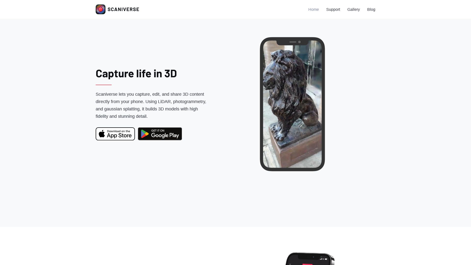
Scaniverse
Unlock the power of 3D scanning with Scaniverse, an innovative mobile app that caters to all recent iPhones and iPads. With a flair for creating highly accurate 3D models via photogrammetry, Scaniverse thrives where other apps fade.
Scaniverse Top Features
Phenomenal Accuracy: Leveraging the capabilities of LiDAR-enabled devices, Scaniverse ensures your models are metrically accurate.
Multi-format Export Options: OBJ, FBX, USDZ, LAS – whatever your preferred format, Scaniverse has you covered.
Broad Compatibility: Import your models directly into renowned 3D modeling software like Blender and Maya, as well as game engines such as Unity and Unreal.
Detail Mode: For high-quality, detailed, and accurate 3D models, there’s no beating Scaniverse’s Detail Mode.
Web and AR views: View your scans in immersive 3D or augmented reality (AR) presentations.
Non-LiDAR Device support
Scaniverse 2.0 holds a competitive edge over its predecessors by extending support to non-LiDAR devices.
Future Processing Options
The scene is never set in stone – Scaniverse allows for raw data exports, allowing future processing and adaptability.
Mesh Simplification
In a bid to streamline model building, Scaniverse provides mesh simplification.
Scaniverse Limitations
Limited support for Landscape and Portrait mode may inconvenience certain users.
Previous versions offer no support for viewing scans on non-LiDAR devices – a limitation addressed with the launch of Scaniverse 2.0.
Scaniverse Pricing
Here’s a welcome surprise – Scaniverse is completely free. Yes, you read that right: a feature-rich, user-friendly AR modelling app that won’t cost you a dime.
Scaniverse Use Cases
Casual Scanning
Scaniverse is perfect for those seeking a user-friendly yet accurate solution for their casual scanning needs. Whether it’s capturing 3D references or creating models for AR visualizations, this app delivers.
Aided Design
Exporting point clouds in multiple formats makes Scaniverse the ideal companion for 3D modeling and game design software. With ready-to-use, precise models, you can streamline your projects like never before.
Social Sharing
Easily create videos from your scans and share your creations on social media directly from the Scaniverse platform.
PolyCam Pro
An app designed to bring LiDAR scanning and photogrammetry to your mobile device or DSLR camera, PolyCam Pro has gained worldwide popularity in the 3D scanning space. Free for basic users and reasonable for Pro subscribers, it’s simplifying the process of capturing reality across industries.
PolyCam Pro Top Features
Straightforward LiDAR Scanning on Pro iOS devices for quick 3D captures.
Photo Mode that turns your smartphone into a photogrammetry powerhouse.
360 Photos Mode for instant spherical imaging and skybox images.
Free 3D Models for immediate use across creative projects.
Teams Function for collaborative content and user management.
Compatible with Blender, Unity, Unreal, Cinema4D for extensive utilization.
Feature
Description
Drone Mapping
Converts drone footage into 3D models seamlessly.
AR Videos Creation
Enables the creation of AR videos, enhancing e-commerce experiences.
Object Recognition
Identifies and adds generic furniture to room scans in Room Mode.
PolyCam Pro Downsides
LiDAR Scanning feature is only supported on Pro iOS devices.
Photo Mode on Android is still under development.
360 Capture comes with a watermark in the free base edition.
PolyCam Pro Pricing
PolyCam Pro offers a free version for basic users, with premium features available at $39.99 per year for those seeking more comprehensive functionality and watermark-free exports.
PolyCam Pro Use Cases
Use Case 1: Professional 3D Workflow
Perfect for creating detailed floor plans and architectural renderings, facilitating VFX and filmmaking, 3D artistry, and scene building.
Use Case 2: Interior Designers and Architects
Ideal for capturing precise dimensions of rooms for improvements, creating stunning 3D models, and generating architecture plans.
Use Case 3: E-commerce
AR videos creation enhances product visualization, accurately representing items for sale.
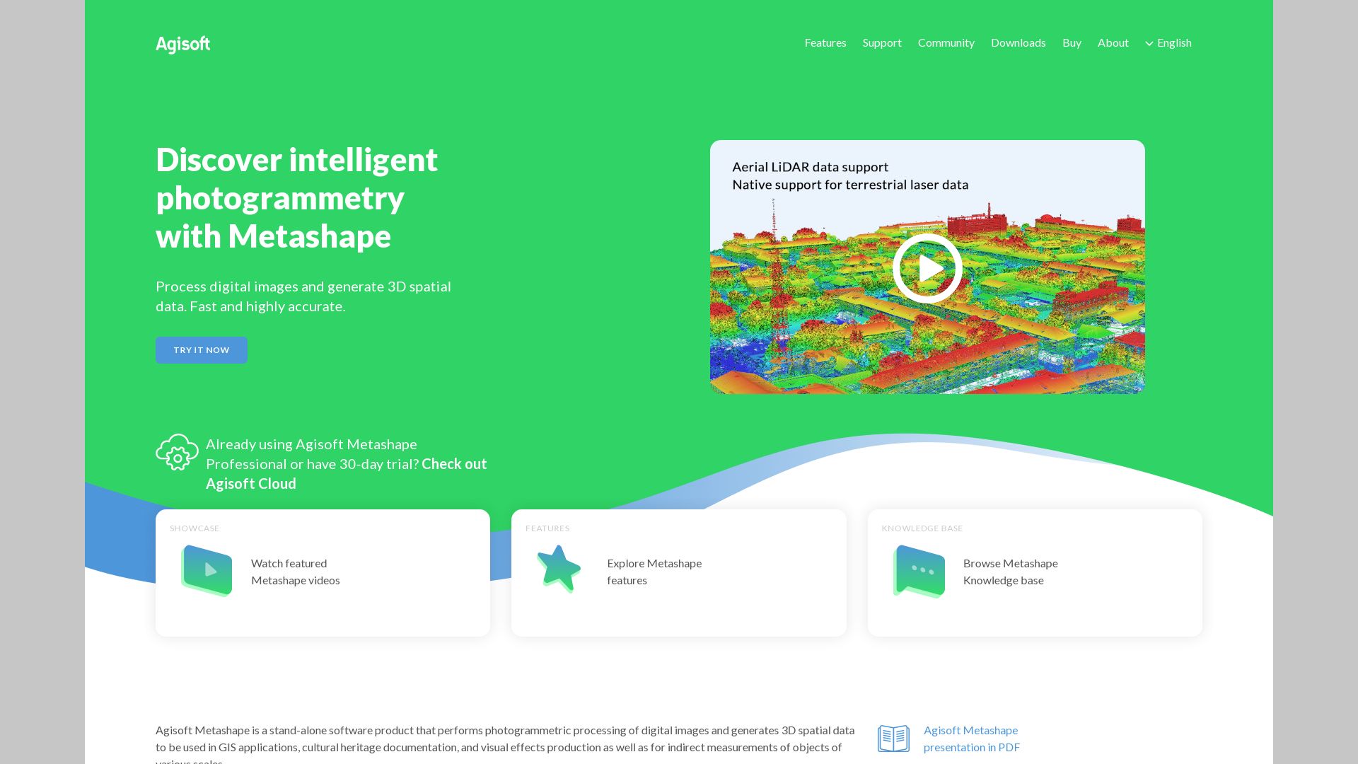
Agisoft
Agisoft is a robust player in the field of photogrammetric software, particularly renowned for its product – Metashape. Previously known as ‘Photoscan’, Metashape has carved a niche for itself in the commercial market.
Agisoft Top Features
Exceptional Performance: Over the years, Metashape’s processing speed has more than doubled, announcing noteworthy improvements.
High-Quality Models: The software can generate superior models via its mesh-generation functionality, using depth maps to eliminate noise and enhance details.
Refining and Constructing Mesh: Apart from creating a mesh from depth maps, the software incorporates tools for refining it, leading to more precise models.
Import Directly from Video: Agisoft Metashape introduces a unique tool which allows for direct video import, decomposing them into individual frames for user convenience.
Advanced Masking Tools: The software features comprehensive masking tools for effective background removal and a streamlined point cloud environment.
Feature
Description
Export:
Models can be exported in various formats: Wavefront OBJ, 3D pdf, and even for 3D printing (.stl).
360-degree Models:
Metashape provides the capacity to create 360-degree models, with tools for marking, scaling, removing unwanted points, and cropping.
30-day Fully Functional Trial:
Agisoft offers a 30-day fully functional trial for users to ascertain Metashape’s value before purchase.
Agisoft Disadvantages
Although GPU usage enhances performance, users need to exercise discretion and caution when dealing with integrated GPUs.
Agisoft Pricing
Agisoft provides the Metashape standard edition as a perpetual license for $179, with an educational discount option reducing the price to $59. This places Agisoft as an affordable choice in the commercial market.
Agisoft Use Cases
Use Case 1 – GIS applications
Agisoft caters well to Geographic Information Systems by providing high-quality, detailed models and easy-to-use export features.
Use Case 2 – Cultural Heritage Documentation
Metashape’s ability to provide refined meshes and high-detail models makes it ideal for preserving and documenting cultural heritage.
Use Case 3 – Visual Effects Production
The import from video feature alongside the superb model generation capabilities prove Agisoft a powerful tool in the realm of visual effects production.
Metashape
In the realm of 3D modeling and graphics, Metashape stands out as a photogrammetric application. Developed by Agisoft, it’s designed to build either 2D or 3D models from captured images. Operating seamlessly across Windows, Linux, and MacOS, Metashape navigates the expanse from indirect object measurement to VFX production.
Metashape Top Features
Depth Map Models: Metashape offers the unique feature of building 3D models from depth maps, ushering in a new level of detail.
Processing Speed: It boasts processing times improved to twice the speed of previous versions, saving valuable time and enhancing productivity.
Sophisticated UI: The user-friendly interface includes a convenient dark mode and a workflow dropdown summarizing process steps.
Virtual Desktop Compatibility: Catering to modern work paradigms, Metashape supports Virtual Desktop environments.
Texturing and Scaling: Metashape’s richness lies in its texture building and model scaling features, enabling customization and accuracy.
Feature
Description
Align Chunks
Allows merger of individual models into a single one
Export Formats
Including versatile options such as .obj, .pdf, and .stl
Cloud Dataset Processing
Cloud computing time is purchasable directly from the software for cloud dataset processing
Metashape Limitations
Processing times can be variable, with high accuracy processing potentially requiring more than 19 hours.
Use of markers is recommended for image alignment, indicating a dependency.
Meshing noise may need refinement using Mesh from depth maps, suggesting potential noise in the initial output.
Metashape Pricing
Metashape is priced at a reasonable $179 for its Standard edition while the professional version is available for $3499. The company also offers a substantial educational discount with licenses reaching as low as $59.
Metashape Use Cases
Use case 1
Metashape can be effectively employed in GIS, providing critical data for mapping and understanding geographical relationships.
Use case 2
In the domain of cultural heritage documentation, Metashape emerges as an invaluable tool, generating highly accurate 3D models of artefacts and historical sites.
Use case 3
As an indirect measurement device, Metashape effectively calculates dimensions and scaling within 3D models, potentially useful in industries such as architecture and engineering.
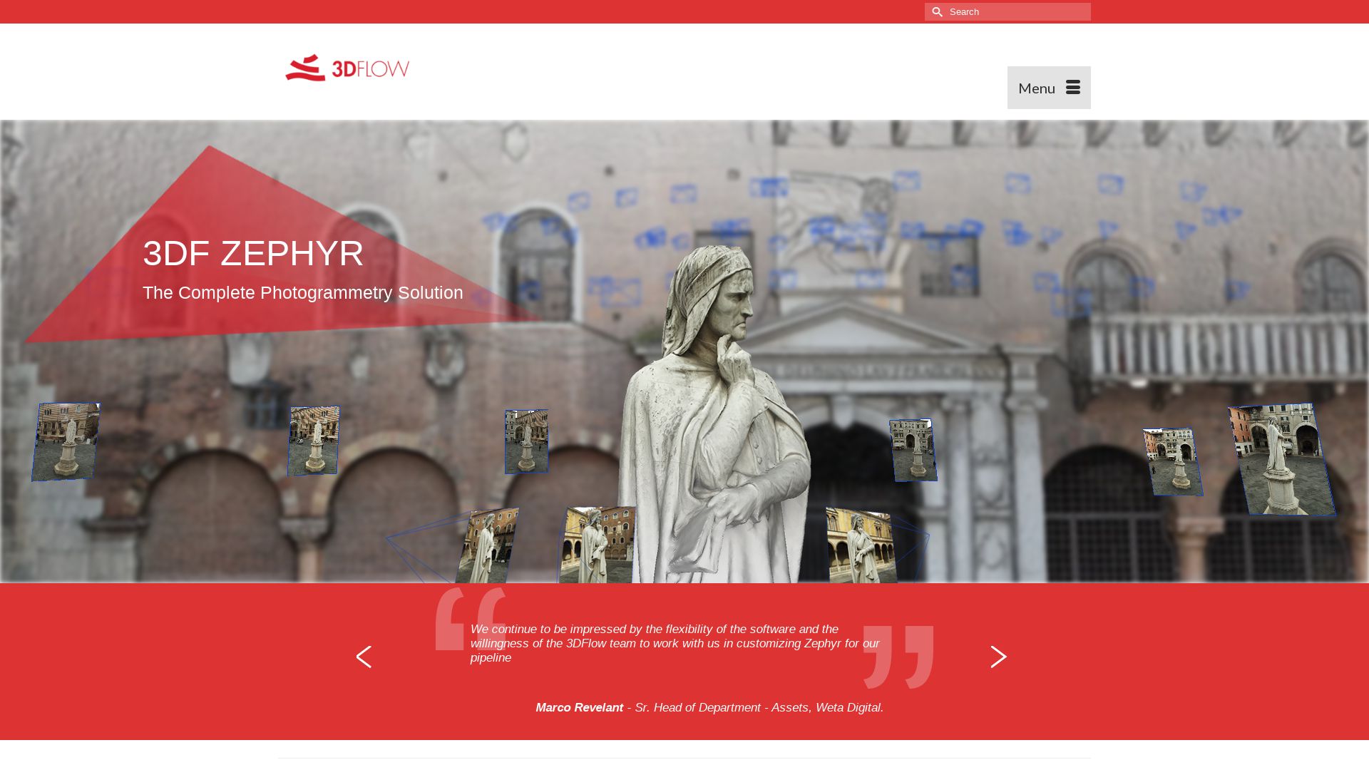
3DF Zephyr
Step into the world of 3DF Zephyr, an avant-garde software developed by 3Dflow. This Italian software company revolutionizes 3D model reconstruction from photos and automates photogrammetry processes.
3DF Zephyr Top Features
Offers complete 3D model reconstruction automation from photos or videos.
Equipped with multi-GPU support for fast performance and efficiency.
Supports wide variety of camera sensors, drones, and laser scanners.
Includes full photogrammetry, laser scans, and post-processing tools in one application.
Possesses advanced control over four processing steps: meshing, editing, transforming, selection.
What Sets It Apart
Benefit
Integration with laser scanning
Allows for accurate scaling via ground control points.
Auto-Masking Tool
Facility to automatically exclude image background for a cleaner 3D model in Lite and Pro versions.
Print and Detect Coded Targets
In Pro version, enhances precision and automation in data capture and processing.
3DF Zephyr Limitations
Limited to Windows application but can work on Linux with Wine.
Free version only supports single NVIDIA GPU and limits to 50 photos.
Hefty price tag for Pro and Aerial versions.
3DF Zephyr Pricing
3DF Zephyr offers flexible pricing models. The free version comes with basic capabilities, while the Lite version permits unlimited images and dual NVIDIA GPU support for €199.00 + VAT. The Pro and Aerial versions with full features are available for a perpetual license at €4200.00 + VAT or as a monthly subscription at €250.00 + VAT.
3DF Zephyr Use Cases
Use case 1: 3D Content Creation
For content creators looking to blend physical and digital worlds, 3DF Zephyr’s automation and accuracy in 3D model reconstruction from photos and videos can be a game-changer.
Use case 2: Drone Mapping
For drone operators and aerial photographers, the software’s capability to generate true orthophotos, Digital Terrain and Surface models makes it an ideal tool for precision mapping.
Use case 3: Laser Scanning Projects
For surveyors and engineers, features such as the ability to perform CAD drawing, generate sections, paths, contour lines, and integrate with laser scanning become indispensable for large-scale projects.
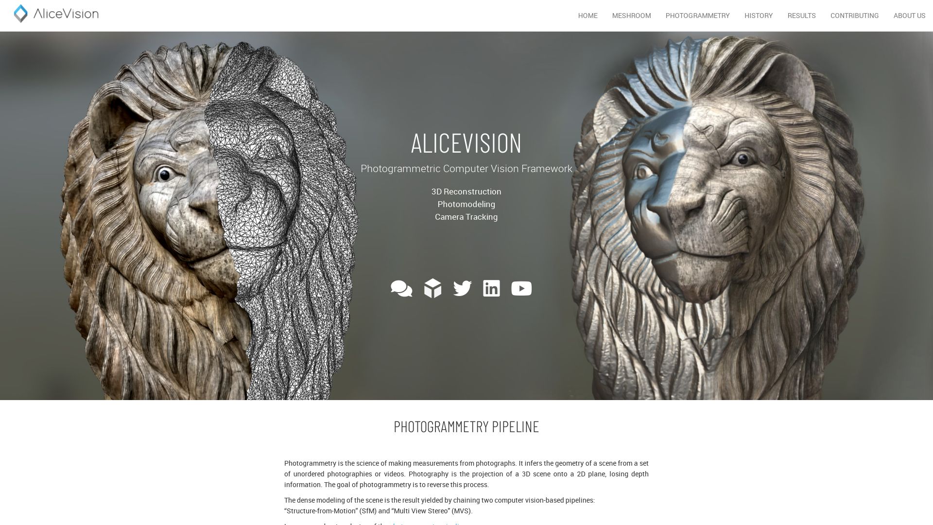
Meshroom
Introducing Meshroom—a cutting-edge, free, open-source 3D Reconstruction Software based upon the AliceVision framework. Born out of a potent collaboration between academia and industry, this potent tool offers robust and high-quality algorithms for production.
Meshroom Top Features
3D Reconstruction and Camera Tracking algorithms – Designed for high accuracy and precision.
Compatibility with Render Farm Systems – Ensures seamless integration for efficient workflow.
Customization for Studio Pipelines – Provides ample space for personal tweaks and adjustments.
Accommodates Various Input Tools – Accepts Blender, Maya, Houdini plugins, etc.
Real-Time 3D Capture – Targeting textured, rough items ideal for photogrammetry.
Feature
Description
Availability
Compatible with both Windows and OSX/Linux systems.
Photogrammetry Capabilities
Allows extended photogrammetry possibilities for large-scale projects.
Applications
Varied application across industries like Robotics, Medicine, Video games, movies.
Meshroom Limitations
Dependency on Lighting and Texture – Requires coating glossy or transparent objects with powder/flour/chalk spray or using painters tape for better results.
Video Input Quality – Video input is acceptable, but yields lesser quality than still images.
Meshroom Pricing
Adding delight to its expansive set of features, Meshroom is absolutely free! As an open-source tool, it presents users with the promising advantage of scalability sans price constraints.
Meshroom Use Cases
Use case 1 – 3D Printing & Scanning
Meshroom packs immense utility for those into 3D Printing and Scanning, thanks to its impressive photogrammetry features and compatibility with various plugins.
Use case 2 – Movies and Video Games
In the realm of cinematography and video gaming, Meshroom comes in handy for previz systems—with the ability to mesh reality and virtual in an evocative blend.
Use case 3 – Medicine
In medicine, Meshroom enables large-scale projects such as CT scanned human body models to be developed with fine attention to detail and realism.
ContextCapture
Step into the world of ContextCapture, an innovative software by Bentley Systems. Utilizing photos or LiDAR point clouds, this efficient software creates accurate 3D models, breaking the boundaries of reality modeling and visualization. It is part of the Reality Modeling WorkSuite and is built to produce high-quality 3D meshes suitable for varying infrastructure projects.
ContextCapture Top Features
Creates precise reality meshes, 2.5D digital surface models, and true orthophotos.
Fastest processing speed to automate 3D mesh generation workflow.
Offers highest fidelity desktop capabilities for creating digital context.
Integrates seamlessly with GIS formats in any workflow.
Designed for scalability, handling large-scale datasets efficiently.
Feature
Benefit
Uses machine-learning technology
Detects, locates, and classifies reality data
Parallel processing
Leverages GPU computing, multi-core computing, and advanced bundle block adjustment to speed up production
Cloud-based service
Enables processing projects on a scale as large as entire cities
ContextCapture Limitations
Some might find the level of detail generation and adaptive tiling system complex.
With the wide range of capabilities, ContextCapture could have a steep learning curve for novice users.
ContextCapture Pricing
One of the major advantages of ContextCapture is its cost-effective method of creating 3D models. The pricing details are, however, not explicitly provided in the summary and are likely dependent upon the scale and requirements of your project.
ContextCapture Use Cases
Urban Planning and Infrastructure Development
ContextCapture has revolutionized the field of urban planning. By generating precise 3D models, city planners can visualize proposed infrastructure with unparalleled accuracy.
Architecture and Construction
For architects and construction professionals, ContextCapture plays a crucial role in creating detailed 3D models of buildings and structures, aiding the design and construction process.
Cultural Heritage and Tourism
ContextCapture is instrumental in preserving cultural heritage by creating high-quality 3D models of historic artifacts and sites, providing a technological boon for the tourism industry.
Canvas
In the realm of on-the-fly graphics creation, HTML element takes precedence. Typically harnessed with JavaScript, it draws the curtains for unmatched interactivity throughout the graphical journey.
Canvas Top Features
Flexibility to draw paths, boxes, circles, text, and images.
Supports creation of graphical data presentations, animations, and gaming applications.
Multiple
RenderingContext ensures a display on the initially blank
Feature
Description
Canvas API
Used to draw “raster” graphics or manipulate objects at pixel level.
Drawing Styles
Enhance graphics quality by applying styles to all subpaths represented with stroke or fill method.
CanvasImageSource
Utilized to draw images directly to canvas.
Canvas Limitations
Actual graphics require scripting – the platform only provides a house for graphics.
Limited native support from Internet Explorer 8, requiring the application of ExplorerCanvas script.
Canvas Use Cases
Use case 1
Canvas is instrumental in sculpting dynamic Web Applications* with rich, interactive graphics, breathing life into seemingly flat dimensions.
Use case 2
Fostering data presentation through custom visuals and animations*, Canvas takes informational spreadsheets to visually engaging narratives.
Use case 3
Inventing an immersive playground for browser-based gaming*, Canvas leverages its on-demand graphics capabilities to engrave fun onto the web page.
PolyCam
An innovative solution for 3D scanning, PolyCam is accessible on multiple platforms including iOS, Android, and the web. Developed by Polycam Inc., it leverages LiDAR scanning, photogrammetry, and 360-degree panorama capture for comprehensive reality capture.
Top Features of PolyCam
3D Capture: Capture real-world objects in 3D with ease.
LiDAR Scanning: Utilize iPhone’s built-in LiDAR for detailed captures.
360 Photos: Create panoramic images with the AI-based 360 Capture system.
Measurements: Obtain inch-level accuracy with the integrated measurement tool.
Collaborative Editing: Share and explore 3D models on the community platform.
Feature
Description
Room Mode
Generate interactive floor plans using LiDAR, ideal for furniture placement and space planning.
Various Export Options
Export in multiple formats compatible with Blender, Cinema4D, Unity, Unreal with the Pro edition.
Video Making
Offers the feature to create videos in Orbit, Path, or custom modes.
PolyCam Limitations
Device Requirement: For LiDAR captures, you need a device with a LiDAR sensor.
Texture Limitation: Captures can appear black on mobile web browsers if the texture is larger than 4K.
Photo Mode Availibility: Android version with Photo Mode is expected soon but not currently available.
PolyCam Pricing
PolyCam Pro edition is priced at $14.99/month or $79.99/year. This unlocks advanced export formats along with unlimited Photo Mode captures.
PolyCam Use Cases
Use case 1 – Contractors and Architects
PolyCam provides invaluable tools such as the Room Mode feature, precise measurement tool, and various 3D capture features that can assist contractors and architects in planning and visualization.
Use case 2 – VFX and Filmmaking
With its ability to export in formats compatible with popular graphics software like Blender and Cinema4D, PolyCam can serve as an efficient tool for VFX artists and filmmakers.
Use case 3 – 3D Artists
Polycam’s detailed 3D scanning and exporting capabilities, coupled with its community platform for sharing and exploring models, fruits a potent environment for 3D artists to create and share their work.
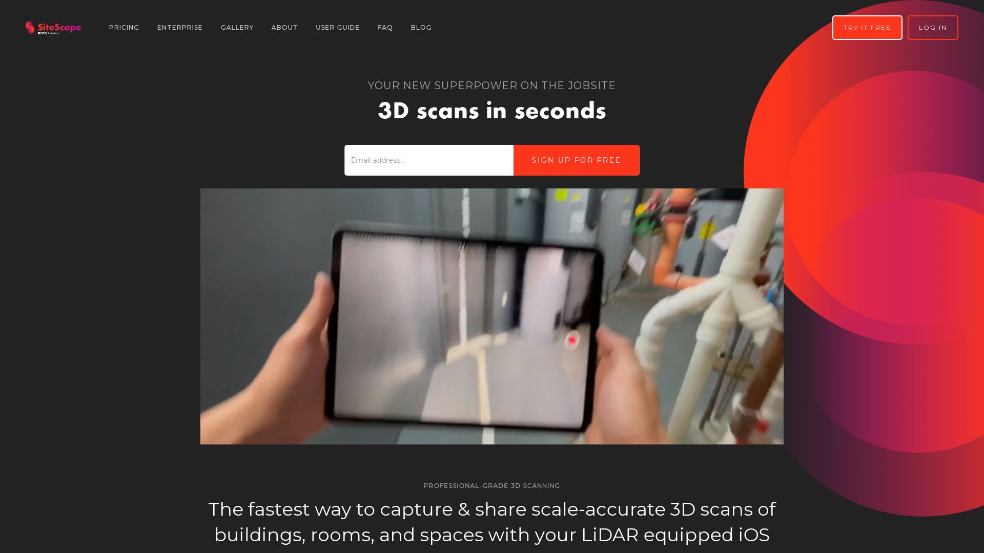
SiteScape
Enter the contrarian – SiteScape, a LiDAR 3D scanning app engineered with audacity specifically for the architecture, engineering, and construction behemoths. With precision to the inch, it’s a rebellion against perception, daring to redefine reality on your iPad and iPhone Pro.
SiteScape Top Features
Pin-point accuracy to an inch for libre capture of existing conditions and as-built scenarios.
One-click export of hefty scanned datasets in .PLY or .E57 file formats, soon with RCP.
Unabashed compatibility with CAD, BIM and point cloud processing software, boosting efficieny.
A direct cloud storage and sync line for Pro account holders, Fort Knox ain’t got nothing on this.
Intrepid user verification by email confirmation, adding an extra layer of security.
Feature
Description
MeshLab Tools
Features like Model Reset, Translate, and Reduce brought to you by the open-source weaponry – MeshLab.
Two Scan Modes
Max Area and Max Detail, that can be swapped per object scanned with a flick.
Point Density
Flexibility to tweak the density of your point cloud, no compromises.
SiteScape Limitations
Limited storage and functionality for non-Pro users, cloud limit capped to only one scanned model.
Subscription model for Pro may not be fit for all budgets.
SiteScape Pricing
Hold on to your seats, this is where it gets interesting. SiteScape Pro for those on an audacious pursuit of unlimited scans in the cloud will run you $468 per year or a monthly hit of $49.
SiteScape Use Cases
Use case 1
Got a meticulous project with complex, large, and intricate structures? SiteScape has you covered with its superb, flexible scanning options.
Use case 2
In the realm of web development? SiteScape will chauffer your scanned models straight to WebGL. Plus, heft models can conveniently be simplified for an easy web handling ride.
Use case 3
Wear the crown of organisation with SiteScape Pro that’s designed to streamline and organize your workflows, keep comments on 3D models, and enjoy unlimited cloud capacity.
Logan Bellbrook
Content writer @ Aircada with a knack for nature & AR/VR/XR. Blogging the intersection of tech & terrain.